Bell County Cemeteries
[ TXBELL HOME PAGE ] [ CEMETERY PROJECT ] [ BELL CO ARCHIVES ]
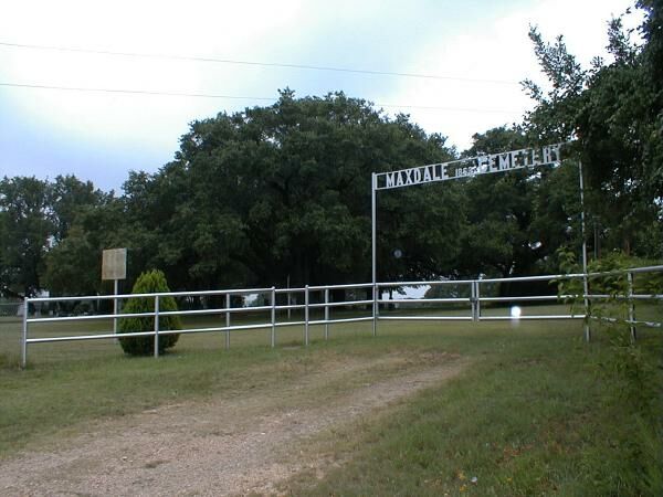
Maxdale Cemetery
CEMETERY DETAILS
| COMMUNITY | Maxdale, SW of Killeen |
| STILL IN USE? | Probably |
| LIST OF BURIALS AVAILABLE ONLINE? | Yes |
| US Geological Survey Coordinates | Unavailable (see below) |
| US Geological Survey TIGER MAP | Unavailable |
| US GEOLOGICAL SURVEY TOPOGRAPHICAL MAP | Available |
| DIRECTIONAL MAP | Available |
| SATELLITE PHOTO | Available |
| DIRECTIONS FROM BELL COUNTY COURTHOUSE | Available |
| TEXAS HISTORICAL MARKERS | Unknown |
GRAVE PHOTOS
| WE NEED YOUR PHOTOS! | WE NEED YOUR PHOTOS! |
| WE NEED YOUR PHOTOS! | WE NEED YOUR PHOTOS! |
RESEARCHERS OF THIS CEMETERY
| Joyce C. Frank |
OTHER INFO
US Geological Survey did not have
coordinates for Maxdale Cemetery. BellNet describes the location as "on the
south side of the old Maxdale Bridge in Maxdale community". I
converted coordinates from the BellNet Cemetery database to find the maps
above. Since the USGS topographical map did indicate an unspecified
cemetery at the coordinates I calculated, accuracy is dependable. The
converted coordinates were
<30 59 13.2 N by 097 49 49.2 W>
BellNet Maxdale Cemetery Photo
Killeen Daily Herald article on Maxdale Cemetery
[ TXBELL HOME PAGE] [ CEMETERY PROJECT ] [ BELL CO ARCHIVES ]
Copyright 2001 by Joe D. Deaver